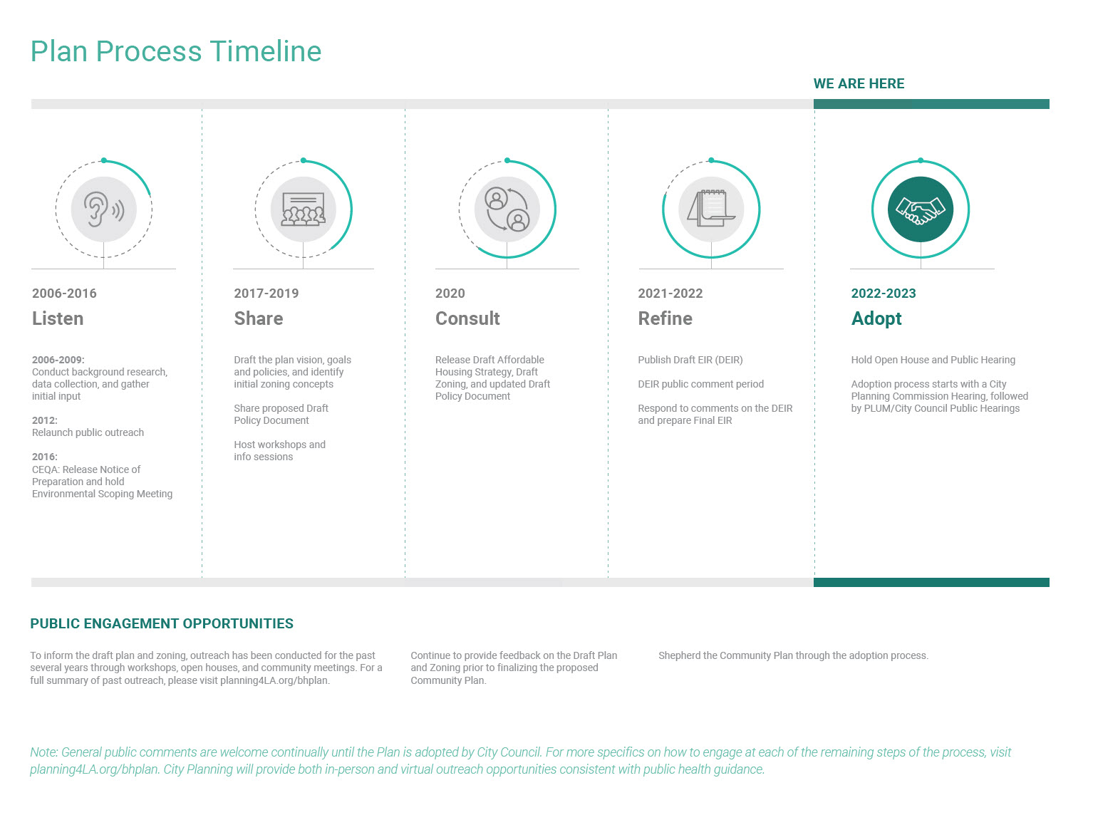

The Los Angeles City Council voted to adopt the The Boyle Heights Community Plan (CF 23-0861) on December 12th, 2023, with amendments. The Council’s vote affirms the fundamental strategies of the Community Plan to address housing security and displacement, bolster the production of mixed-income and affordable housing near transit and employment, address long-standing environmental justice issues, and protect the cultural identity of Boyle Heights.
The Planning Department returned to the City Planning Commission (CPC) on January 11, 2024 for re-consideration of changes made by City Council regarding:
For more information on what was presented to the CPC and attachments, please visit the events tab on this website.
In an effort to make information on the Boyle Heights Community Plan Update more accessible to a wide array of stakeholders, we have developed a four part video series that provides an overview of the Community Plan Update process, Proposed Zoning Tools, Plan Policies and the Community Benefits Program. Please click on the links below to view any of the videos in our four part video series.
What’s Next for the Plan?
During the PLUM Committee consideration of the Plan, several changes were approved to the Plan’s zoning and CPIO ordinances. These changes include new regulations addressing tenants rights, incentives for legacy small businesses, and the expansion of the Plan’s Community Benefits Program to address new hybrid industrial zoning districts in areas adjacent to the Los Angeles river. The City Council voted to amend some portions of the Plan, and then was reconsidered by the City Planning Commission on January 11, 2024. For more information on what was presented to the CPC and attachments, please visit the events tab on this website.
See the timeline below under “Plan Timeline” to see where we are in the Plan process as a whole. Past events and materials are shared on our “Events” tab.
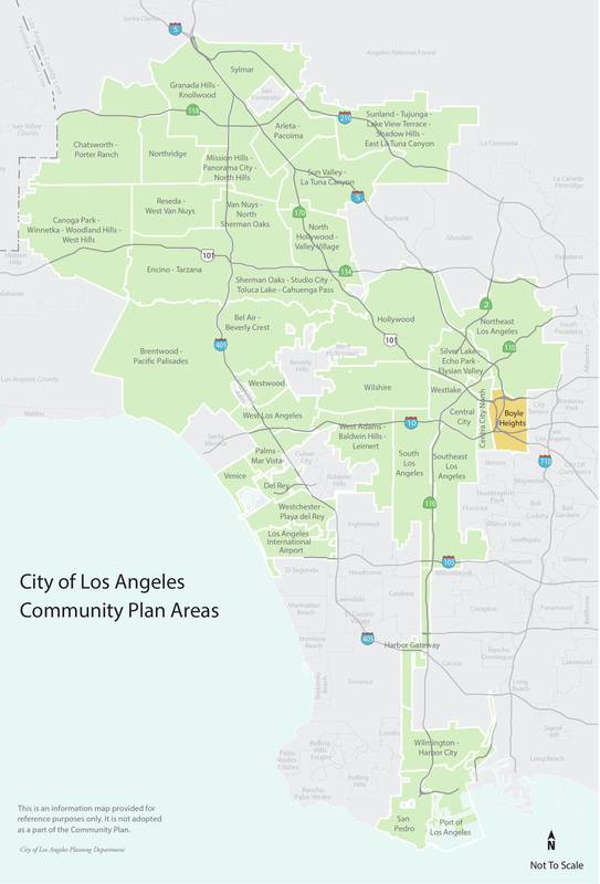
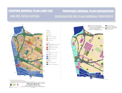
The Boyle Heights Community Plan, one of the City of Los Angeles’s 35 Community Plans, sets goals and policies for the future of Boyle Heights.
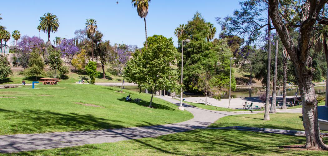
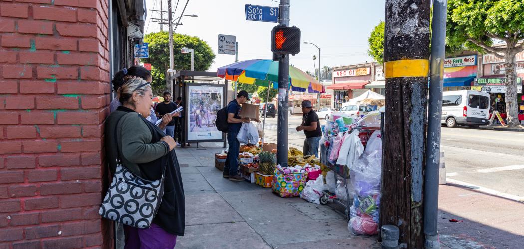
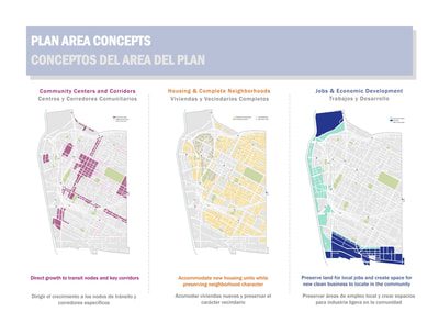
Boyle Heights, a comparatively dense, urban neighborhood, is one of the City’s most transit-accessible communities. The update to the Plan aims to encourage specific growth around transit hubs and commercial corridors while conserving residential areas’ existing varied densities and historic character.
The priorities of the Boyle Heights Community Plan Update are:
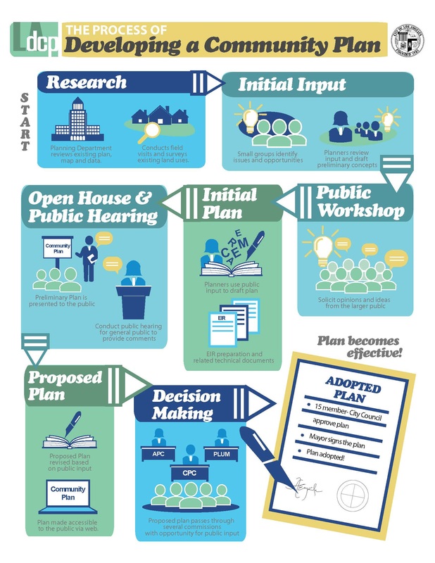
The Land Use Element of the City’s General Plan comprises 35 Community Plans. The policies in each Community Plan set out a vision of the future for an area of the City. Community Plans also designate land for the range of uses needed, including jobs, housing, transportation, open space, and amenities.
Plans guide decision-making when projects are proposed. The Plans tell developers and homeowners the types, densities, and intensities of development that are permitted. They also outline strategies for accommodating planned growth.
What is the purpose of the Plan Update?
The Boyle Heights Community Plan Update takes cues from the City’s General Plan, particularly from its Framework Element, which describes the City’s long-term growth strategy. The Framework Element lays out goals, objectives, and policies for the range of land uses throughout the City, including Boyle Heights, and guides the development of Community Plans. The update will build on Boyle Heights’ diverse historic character and history and will apply new zoning tools developed as part of the City's re:code LA project.
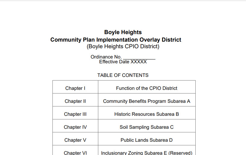
The Boyle Heights Community Plan includes three primary components - the Proposed Plan, the Land Use & Zoning maps, and the Community Plan Implementation Overlay (CPIO). For information on how the plan policies and zoning address various topics, and for more answers to Frequently Asked Questions, please view the documents below.
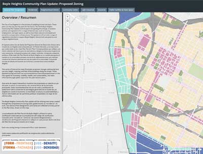
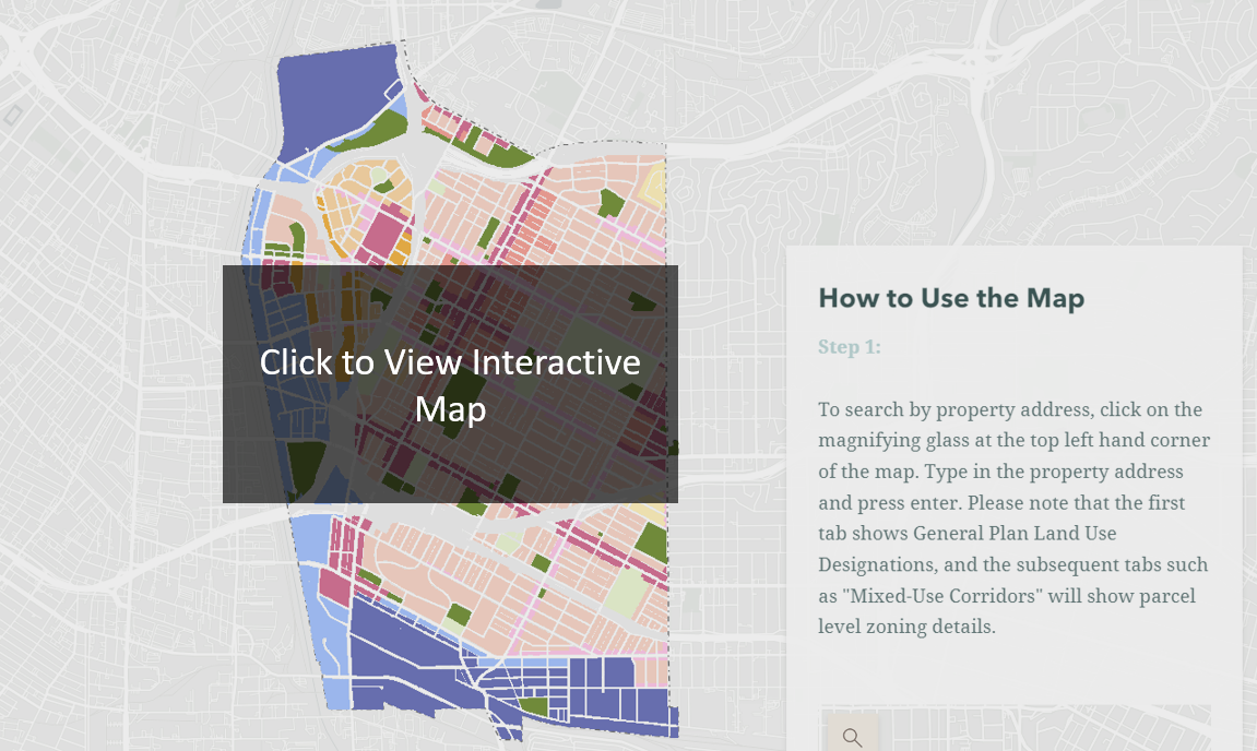
The Boyle Heights Community Plan Update will be utilizing new zones created through the City’s comprehensive zoning code update and implemented through the Boyle Heights Community Plan. The view zoning details for a specific property or address, please visit the Interactive Zoning Map. To view the draft of Boyle Heights Zoning Districts considered by the City Planning Commission in April 2023, please see the links below
Please note: The Downtown Community Plan will bring forward for adoption the New Zoning Code, including the Articles listed below. The Boyle Heights Community Plan will bring forward the unique zones to implement the Boyle Heights Community Plan.
New Zoning Code Articles: Boyle Heights CPC Hearing Draft
Article 1: Introductory Provisions
Article 2: Form Districts in Boyle Heights
Article 3: Frontage Districts in Boyle Heights
Article 4: Development Standards in Boyle Heights
Article 5: Use Districts in Boyle Heights
Article 6: Density Districts
Article 7: Alternative Typologies in Boyle Heights
Article 9: Community Benefits
To view the most up to date Zoning Districts being considered by the City Council, please visit the Council File. To view the comprehensive New Zoning Code adopted by the City Council on May 3, 2023, please view the New Zoning Code website.
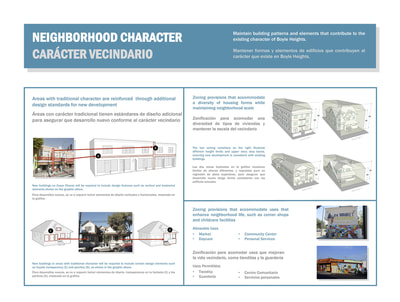
The Draft Boyle Heights Community Plan provides policy guidance for new development in the area, as well as preservation of the community’s traditional neighborhoods.
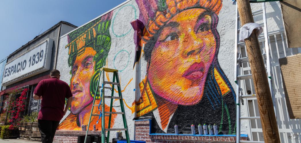
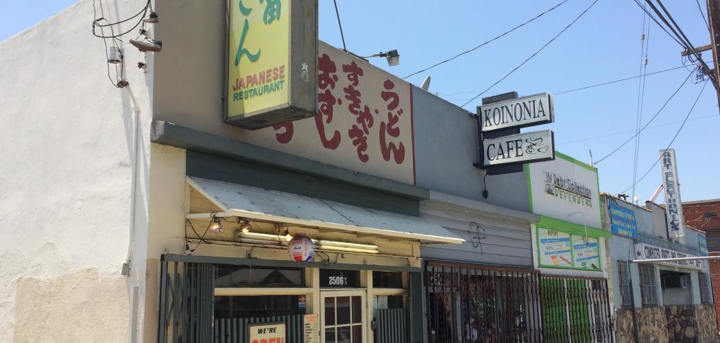
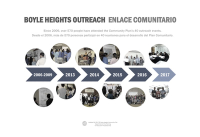
The document’s vision statement, informed by the Department’s outreach to community stakeholder organizations from 2006 through the present, recognizes Boyle Heights’ unique history. "This community was built by generations of immigrants, fostering a sense of pride in the work ethic, rich cultural identity, and community activism of those who call it home," it says. "Boyle Heights is a historic and cultural treasure with a diverse local economy that has the potential to bring prosperity and opportunity to residents of today and to future generations. Building upon its distinctive, pedestrian friendly, traditional neighborhood character, this community envisions a plan that is supportive of environmental quality, economic vitality, and urban design that promotes safe and walkable neighborhoods."
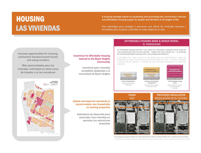
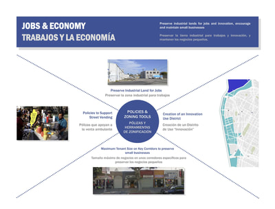
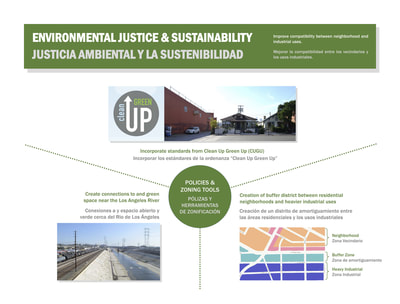
While the Draft Plan proposes policies and new zones that foster thriving transit centers and promote walkable mixed-use corridors, it also includes policies to conserve the neighborhood’s character and preserve industrial land for jobs, innovation, and workforce training. Additionally, the document builds upon the City’s Clean Up Green Up (CUGU) Ordinance, which improves compatibility among industrial uses, neighborhoods, and the Los Angeles River.
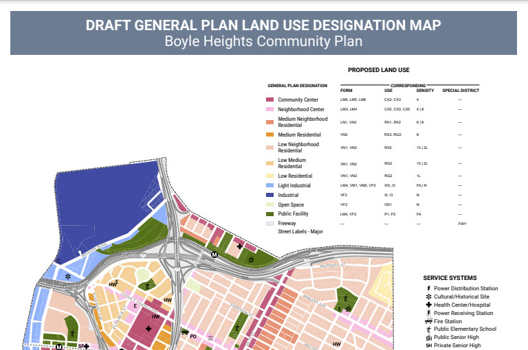
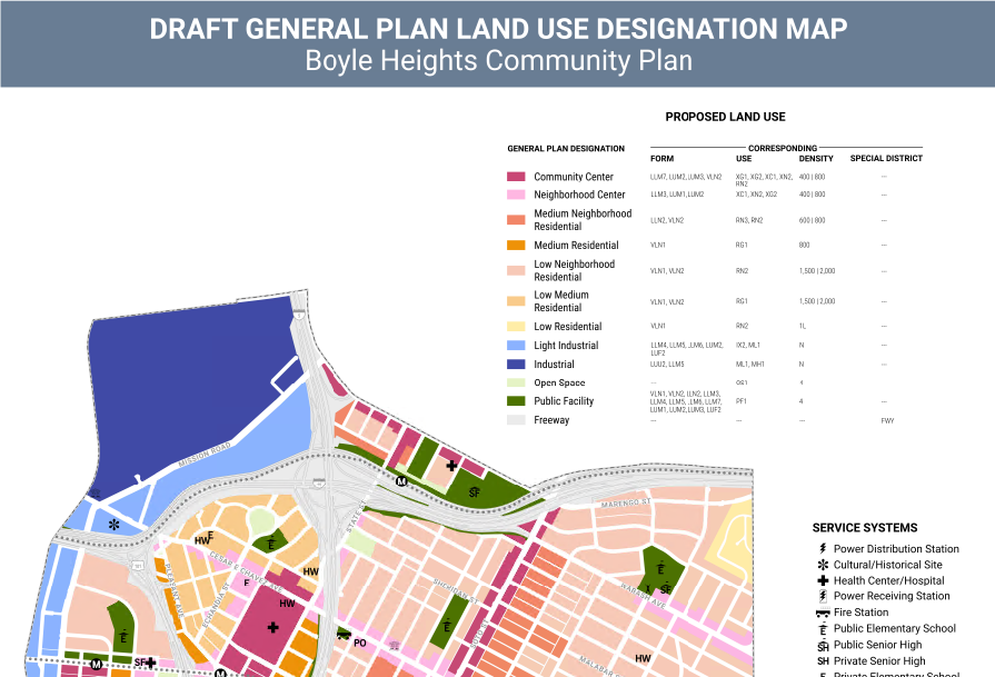
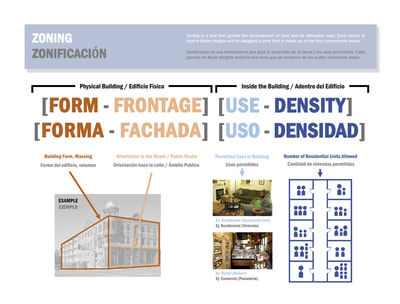
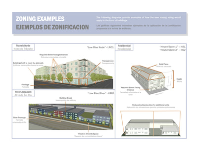
The new proposed zones, developed in conjunction with the Department’s comprehensive revision of the Zoning Code, are tools for implementing the Plan’s vision and goals. They facilitate improved development standards that address buildings’ form and shape, design elements, and ways of interacting with the street. Tailored to the unique development patterns of the community, these new zones will encourage new development that is compatible with the traditional architecture and pedestrian-friendly environments commonly found in Boyle Heights.
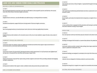
The interactive zoning contains interactive maps with additional content and information that highlights key strategies and policies contained within the Proposed Plan, and the Land Use and Zoning. Please click below to view.
On January 11, 2024, Planning staff presented to the City Planning Commission (CPC) once again for re-consideration of some changes adopted by City Council December 12, 2023 regarding:
Staff Recommendation Report For City Planning Commission held on January 11, 2024
Technical Modifications Memo to CPC
City Planning Staff Presentation to the City Planning Commission
Subscribe to the Boyle Heights CPU mailing list to stay updated on the plan adoption process.
A state law requiring state and local agencies to analyze the potential impacts of their actions on the environment, disclose their findings to the public, and to mitigate impacts where feasible.
The Land Use Element of the General Plan consists of 35 Community Plans. Each focuses on a particular area or community in the City (e.g., Boyle Heights Community Plan).
The number of residential units permitted per acre of land.
Type of environmental review prepared when the City determines that a project may potentially have significant environmental impacts.
The ratio of the gross floor area of a building to the area of the lot where it is located. (This video explains FAR.)
The General Plan is the City’s guide for its future growth and development. The State of California requires every city to adopt a General Plan. General Plans have a typical lifespan of 20 to 30 years and must be updated periodically.
Each General Plan must cover certain topics in sections called Elements (such as Land Use, Housing, and Safety).
The Framework Element of the General Plan lays out goals and policies for topics related to growth and services. All General Plan Elements need to be consistent with the Framework.
Establishes the height and Floor Area Ratio limitations.
Zones or regulations included in the Community Plan that supplement existing zoning regulations and help realize the Plan’s goals for new development.
Development of vacant or underutilized land within urban communities that are nearly fully developed.
The public and quasi-public facilities required in order to serve the development and operational needs of a community, such as roads, water, and sewer systems.
Examples of land use designations include residential, industrial, commercial, and open space. Each land use designation has a list of corresponding zones.
A project that combines compatible uses within the same structure, such as a building with residential uses above ground floor commercial space.
A law or statute enacted by a city government. Zoning is established by ordinance.
A permanent committee of five or more citizens who are appointed by the City to review matters related to planning and development.
Development located near transit. The City’s General Plan encourages locating new housing and businesses near transit to provide convenient alternatives to car travel (e.g., walking, bicycling, taking public transportation).
Zoning determines the uses permitted on a parcel and provides regulations for development, including height, bulk, and setbacks.