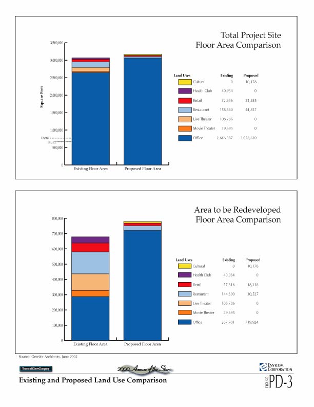
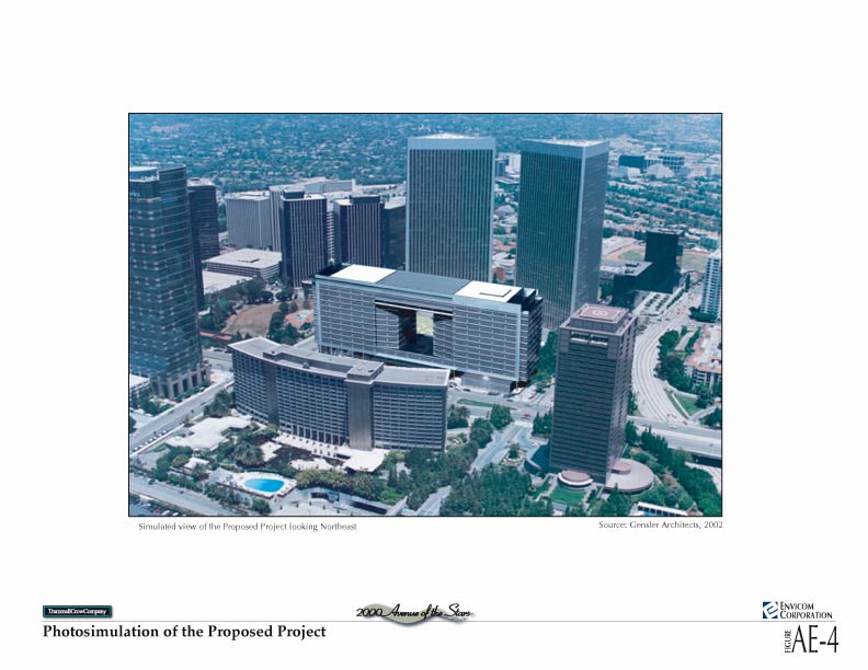
The 2000 Avenue of the Stars Project is a proposed redevelopment of 9.20 acres of a 14.02-acre site within Century City. The project site is currently developed with commercial buildings and is known as the ABC Entertainment Center. The proposed project includes demolition of two eight-story buildings, totaling 678,822 square feet, and construction of a new commercial office building totaling 778,947 square feet. The proposed 15-story building would provide office, restaurant, retail and cultural space.
Graphic exhibits from the Draft Environmental Impact Report are available on-line. Files are provided as either jpeg or gif files. Click here to view the Table of Contents for the text.
LIST OF FIGURES
Figure PD-1 Regional Location (jpg 68k)
Figure PD-2 Project Location (jpg 128k)
Figure PD-3 Existing and Proposed Land Use Comparison (jpg 52k)
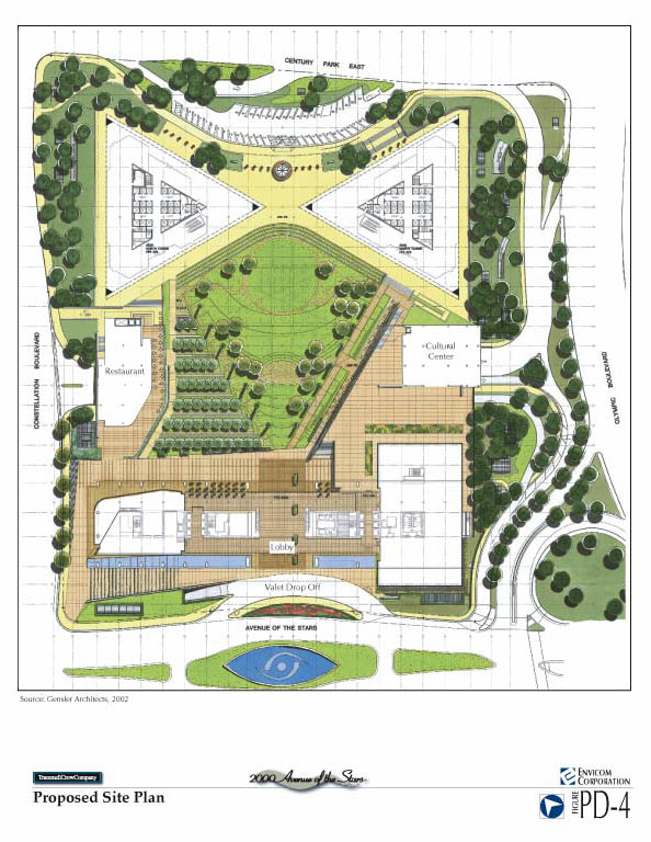
Figure PD-4 Proposed Site Plan (jpg 108k)
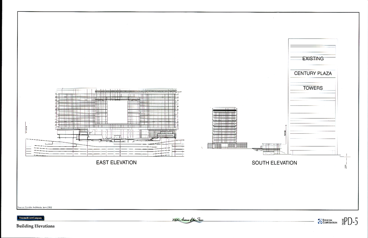
Figure PD-5 Building Elevations (gif 152k)
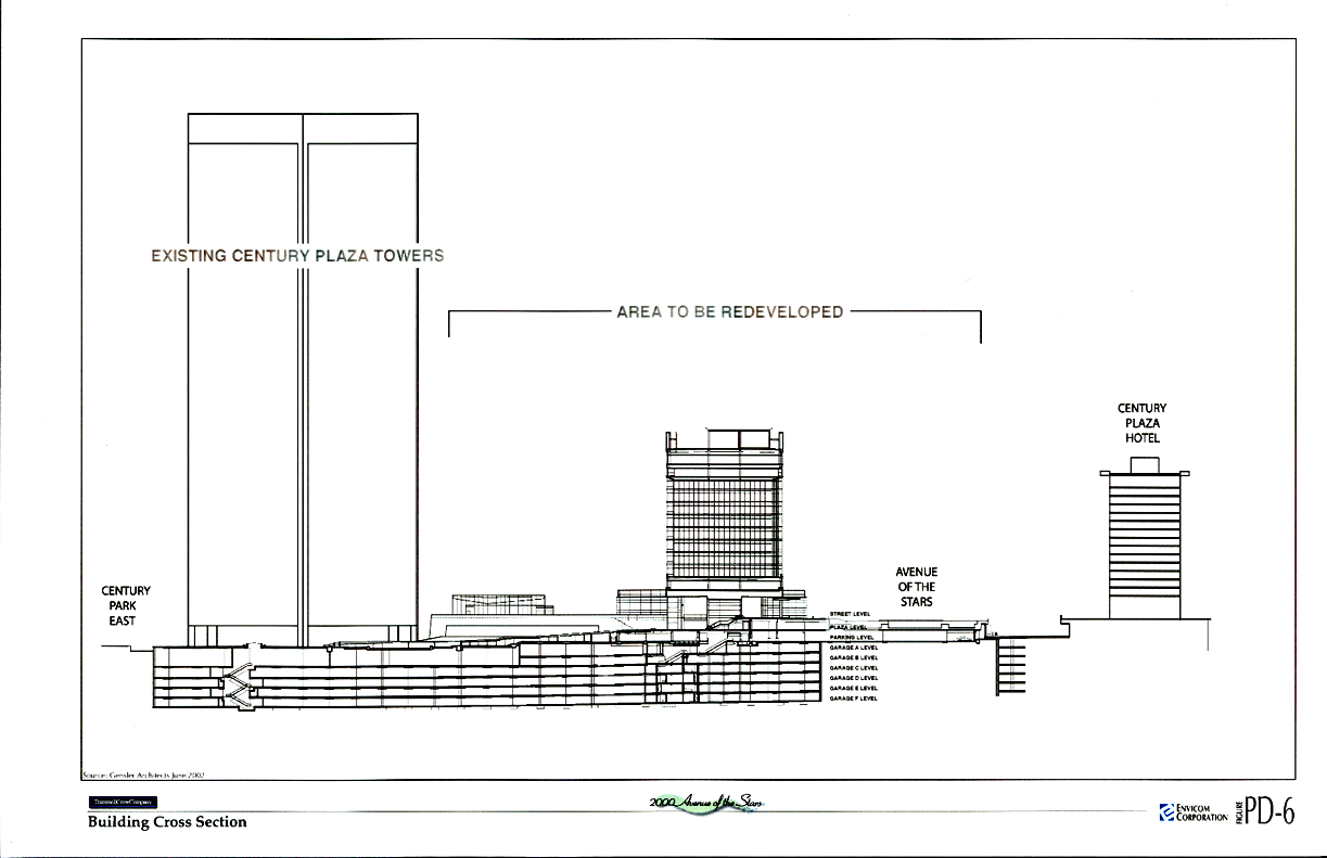
Figure PD-6 Building Cross-Section (gif 116k)
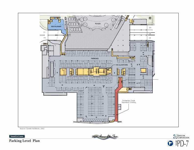
Figure PD-7 Parking Level Plan (jpg 64k)
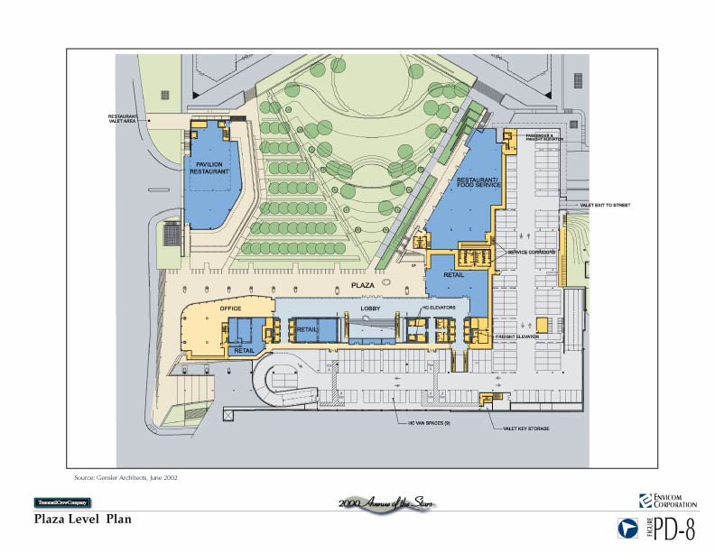
Figure PD-8 Plaza Level Plan (jpg 68k)
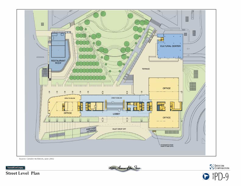
Figure PD-9 Street Level Plan (jpg 64k)
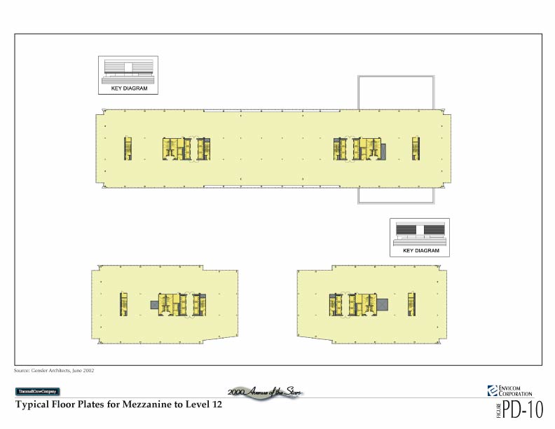
Figure PD-10 Typical Floor Plates for Mezzanine to Level 12 (jpg 40k)
Figure PD-11 Proposed Landscape Plan (jpg 84k)
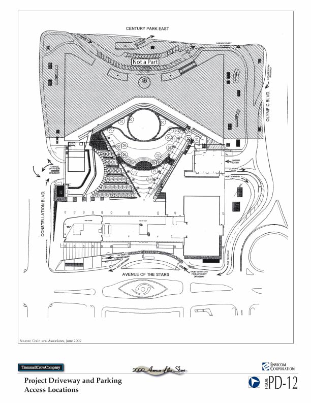
Figure PD-12 Project Driveway and Parking Access Locations (jpg 92k)
Figure PD-13 Artist Rendering of the Pedestrian Corridor (jpg 112k)
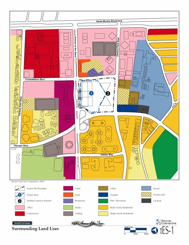
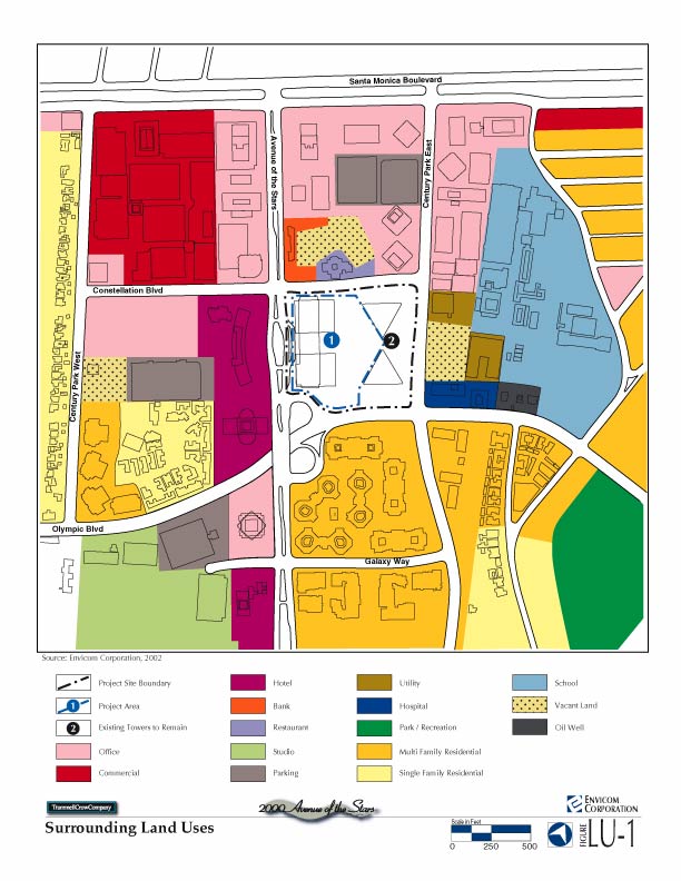
Figure ES-1 Surrounding Land Uses (jpg 92k)
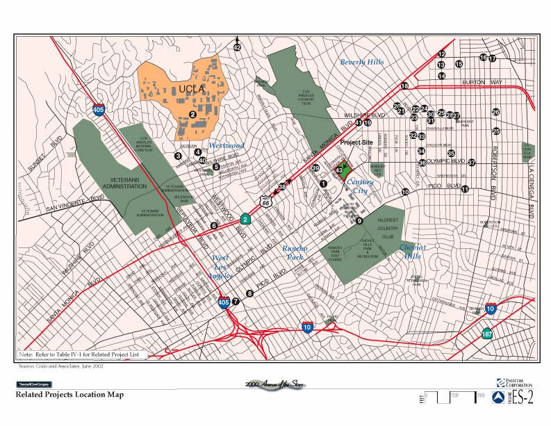
Figure ES-2 Related Projects Location Map (jpg 140k)
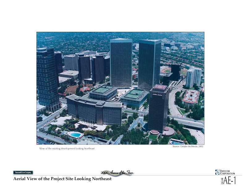
Figure AE-1 Aerial View of the Project Site Looking Northeast (jpg 104k)
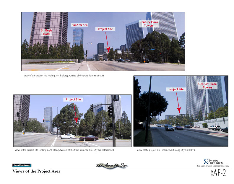
Figure AE-2 Views of the Project Area (jpg 108k)
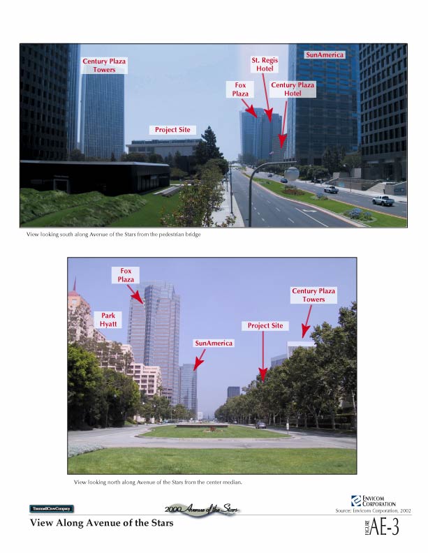
Figure AE-3 View Along Avenue of the Stars (jpg 64k)
Figure AE-4 Photosimulation of the Proposed Project (jpg 68k)
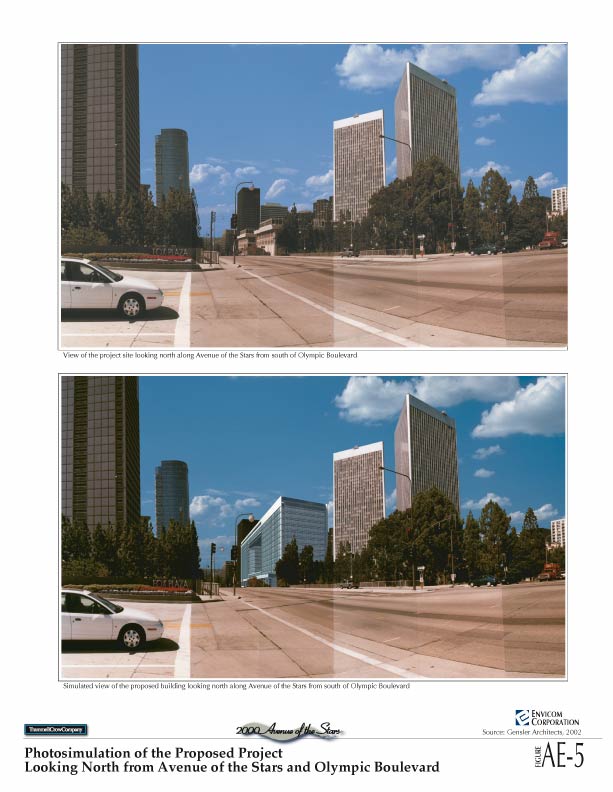
Figure AE-5 Photosimulation of the Proposed Project Looking North from Avenue of the Stars and Olympic Boulevard (jpg 72k)
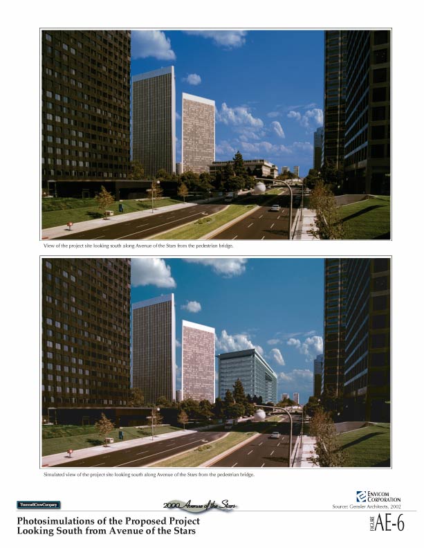
Figure AE-6 Photosimulations of the Proposed Project Looking South from Avenue of the Stars (jpg 76k)
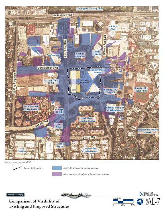
Figure AE-7 Comparison of Visibility of Existing and Proposed Structures (jpg 116k)
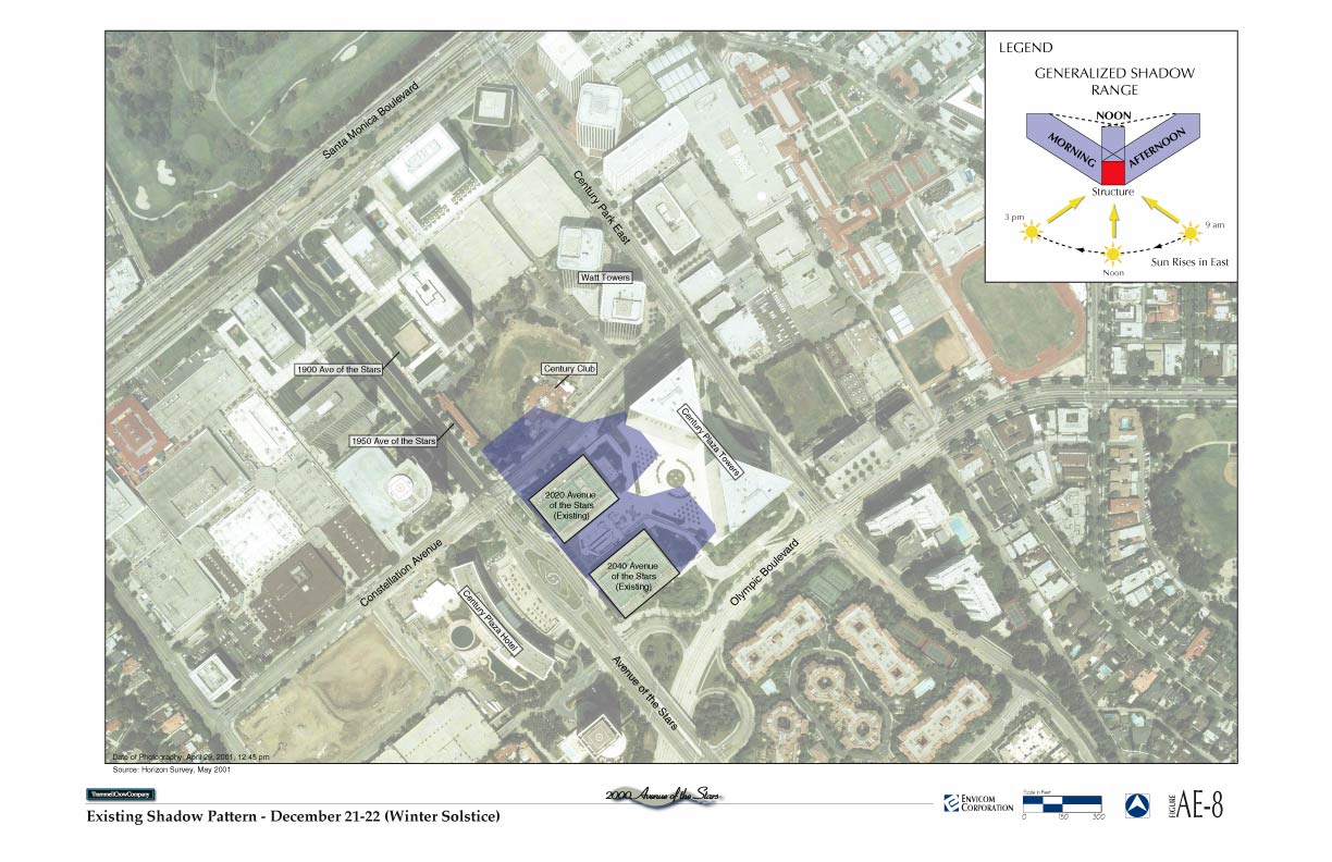
Figure AE-8 Existing Shadow Pattern Ð December 21-22 (Winter Solstice) (jpg 164k)
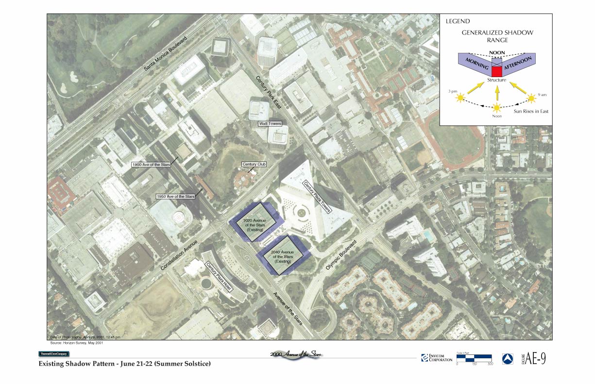
Figure AE-9 Existing Shadow Pattern Ð June 21-22 (Summer Solstice) (jpg 164k)
Figure AE-10 Proposed Project Shadow Pattern Ð December 21-22 (Winter Solstice) (jpg 164k)
Figure AE-11 Proposed Project Shadow Pattern Ð June 21-22 (Summer Solstice) (jpg 164k)
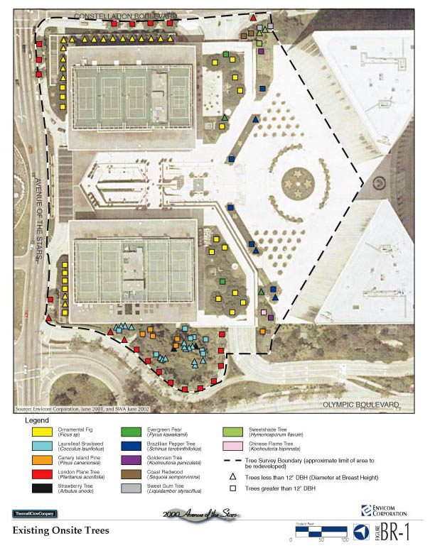
Figure BR-1 Existing Onsite Trees (jpg 108k)
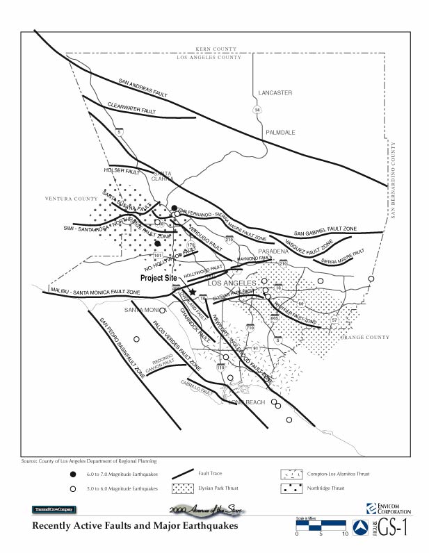
Figure GS-1 Recently Active Faults and Major Earthquakes (jpg 72k)
Figure H-1 Existing Hydrologic Conditions (jpg 84k)
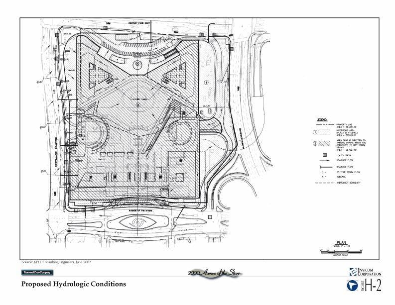
Figure H-2 Proposed Hydrologic Conditions (jpg 92k)
Figure LU-1 Surrounding Land Uses (jpg 92k)
Figure LU-2 West Los Angeles Community Plan Area (jpg 88k)
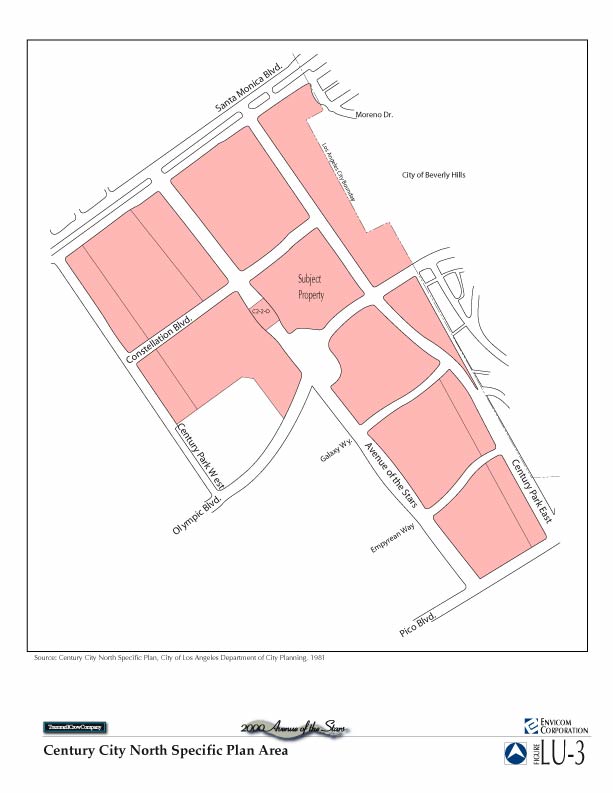
Figure LU-3 Century City North Specific Plan (jpg 52k)
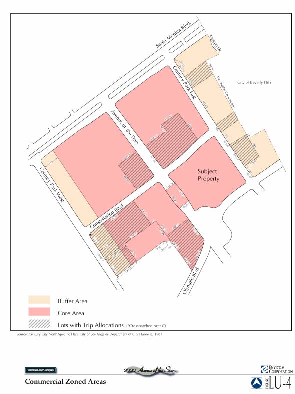
Figure LU-4 Commercial Zoned Area (jpg 56k)
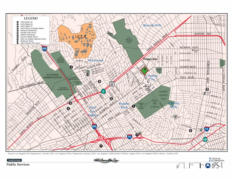
Figure PS-1 Public Services (jpg 136k)
Figure R-1 Public Recreation (jpg 136k)
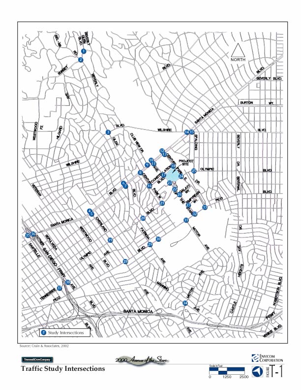
Figure T-1 Traffic Study Intersections (jpg 112k)
Figure T-2 Existing (2001) Traffic Volumes - AM Peak Hour (gif 560k)
Figure T-3 Existing (2001) Traffic Volumes - PM Peak Hour (gif 556k)
Figure T-4 Net Project Traffic Volumes - AM Peak Hour (gif 504k)
Figure T-5 Net Project Traffic Volumes - PM Peak Hour (gif 512k)
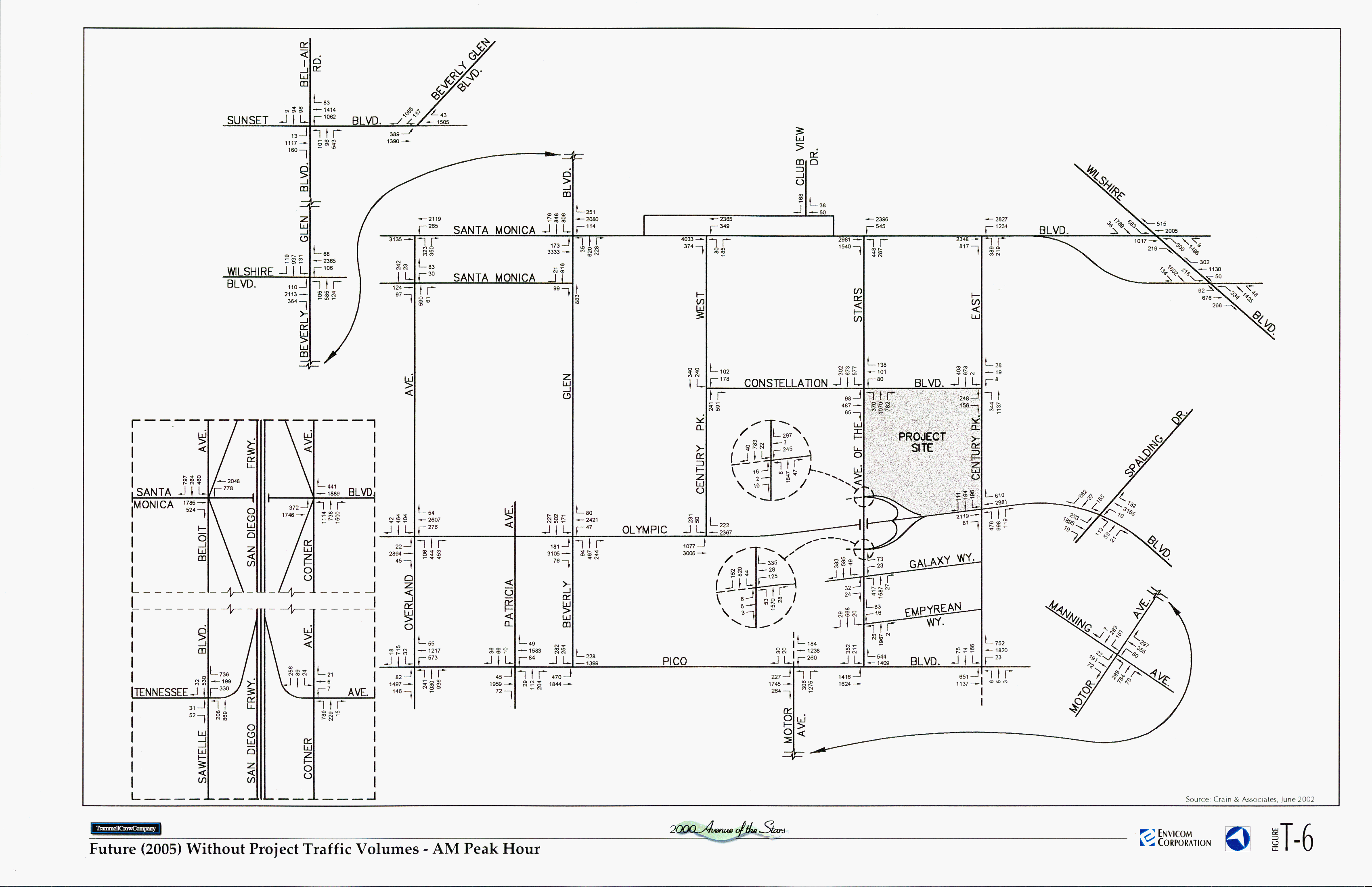
Figure T-6 Future (2005) Without Project Traffic Volumes - AM Peak Hour (gif 540k)
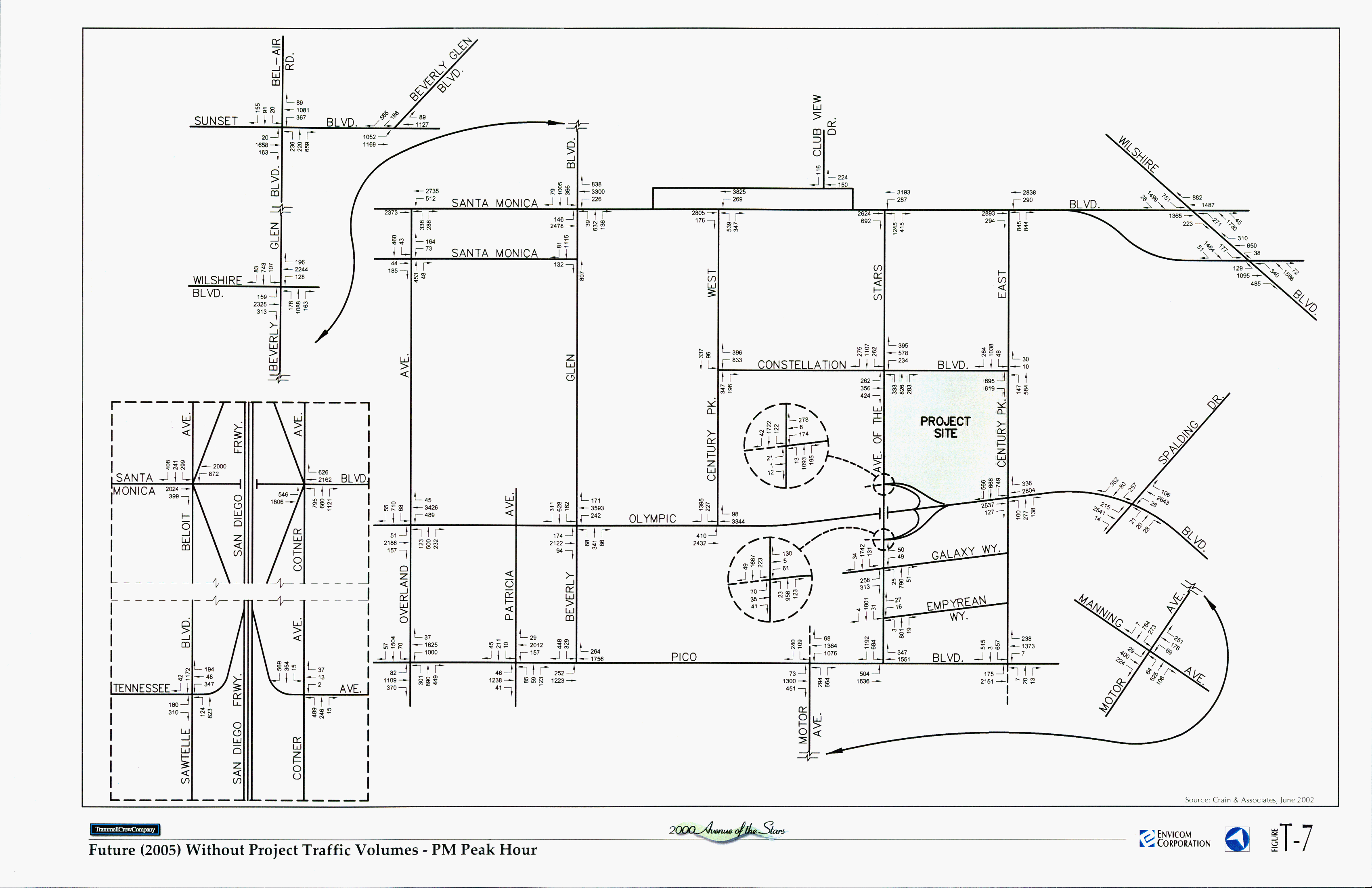
Figure T-7 Future (2005) Without Project Traffic Volumes - PM Peak Hour (gif 536k)
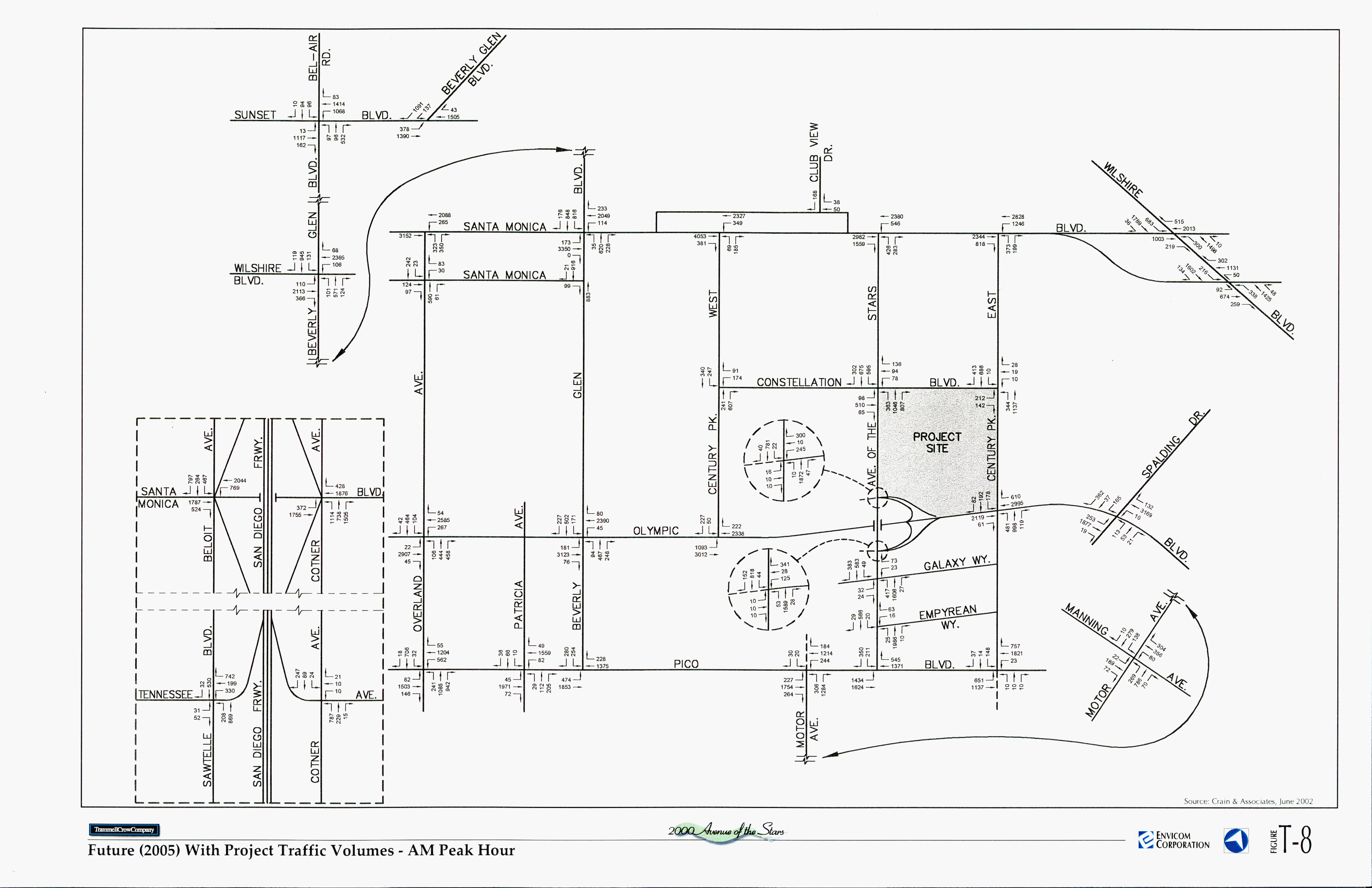
Figure T-8 Future (2005) With Project Traffic Volumes - AM Peak Hour (gif 556k)
Figure T-9 Future (2005) With Project Traffic Volumes - PM Peak Hour (gif 548k)
Figure T-10 Project Demolition and Construction Haul Route (jpg 180k)