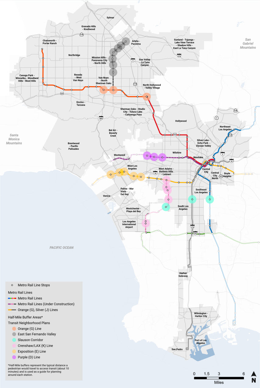
Transit Neighborhood Plans (TNPs) aim to support transit ridership and mobility access, expand future affordable housing opportunities, support economic vitality, and improve the livability of the City. The plans align with citywide policies that support equity and sustainability while tailoring strategies to the context and needs of communities near transit. The TNPs supplement the City’s Community Plans, which establish neighborhood-specific goals and strategies to achieve the objectives laid out in the City’s General Plan. Directing growth to transit areas is an overarching principle of the City’s General Plan, and aligns with broader efforts to reduce automobile dependency and greenhouse gas emissions.
The TNPs will apply land use designations and zoning near transit by utilizing updated zoning tools, including design standards. The updated zoning and land use will accommodate a mix of building types, including incentivizing more affordable housing and amenities.
Each station neighborhood has a unique built environment and distinct mix of housing and businesses, which City Planning will take into account in its approach to the TNPs. Developing plans is a collaborative effort that involves residents, the local workforce, business and property owners, developers, and community organizations. Visit a TNP website below to learn more.
Please note that the design and location of future Metro stations are determined by Metro and therefore outside the scope of these projects.
Planning in progress
Planning complete and regulations adopted
Planning complete and regulations effective
- Crenshaw/LAX Line
- Exposition Line
Planning on pause until the Wilshire Community Plan program commences
